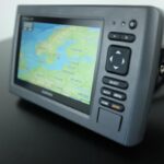
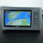
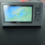
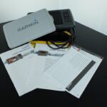
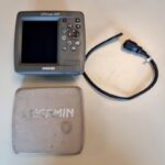

GARMIN echoMAP 71sv ClearVü Chartplotter Fisfinder Sonar 010-01489-00 – PERFECT!
USD569.00
Out of stock
Want to be notified when this product is back in stock?
Description
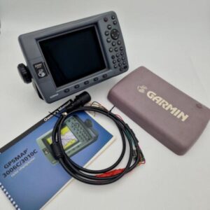
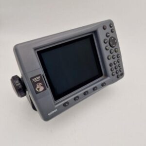
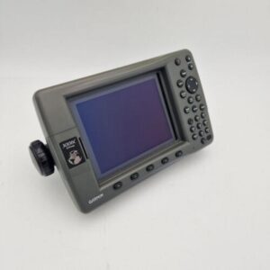
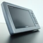
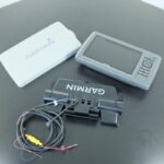
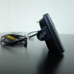
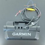
This chartploter and fishing combo is in perfect condition.
******
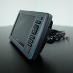
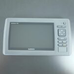
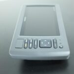
7-inch Combo with ClearVü and SideVü Scanning Sonar
- High-contrast colour display with keypad control with preloaded worldwide basemap
- Built-in ClearVü and SideVü scanning sonar with the clearest images on the water¹
- SideVü scanning sonar with 455 kHz for better performance in shallow waters
- Built-in 500 W (RMS) HD-ID™ sonar (4,000 W peak-to-peak)
- 5 Hz Internal GPS updates position and heading 5 times per second
- Tilting, quick-disconnect mount
echoMAP 71sv includes a 7-inch high-contrast colour display with automatic backlight adjustment. Fast, responsive 5 Hz GPS/GLONASS refreshes your position and heading 5 times each second to make your movement on the screen more fluid. echoMAP 71sv has built-in support for 50/200 kHz, 77/200 kHz and Garmin DownVü™/SideVü™, the clearest scanning sonar on the water. It also supports Minn Kota® and MotorGuide® trolling motors with integrated transducers. The combo’s cords plug directly into the mount, allowing you to quickly install and remove your device from power and the mount.
Clearest Scanning Sonar on the Water
Garmin DownVü scanning sonar gives you a nearly photographic image of what passes below your boat. Garmin SideVü scanning sonar gives you a crisp, clear view of what lies up to 500-feet off to each side of your boat. You clearly see structure, submerged objects and fish. Traditional Garmin HD-ID sonar and both DownVü and SideVü scanning sonar are combined into one transducer. Also provides HD-ID support for Minn Kota and MotorGuide trolling motors with integrated transducers. The echoMAP 71sv also includes sonar-recording capability that coordinates the timing of the sonar return with your boat’s position and saves digital information for playback on a computer using free HomePort™ planning software. Use the User Data Sharing Cable to share waypoints and routes between multiple devices.
Garmin DownVü scanning sonar gives you a nearly photographic image of what passes below your boat. Garmin SideVü scanning sonar gives you a crisp, clear view of what lies up to 500-feet off to each side of your boat. You clearly see structure, submerged objects and fish. Traditional Garmin HD-ID sonar and both DownVü and SideVü scanning sonar are combined into one transducer. Also provides HD-ID support for Minn Kota and MotorGuide trolling motors with integrated transducers. The echoMAP 71sv also includes sonar-recording capability that coordinates the timing of the sonar return with your boat’s position and saves digital information for playback on a computer using free HomePort™ planning software. Use the User Data Sharing Cable to share waypoints and routes between multiple devices.
Heading and Position Refreshed 5 Times per Second
Fast, responsive 5 Hz GPS/GLONASS refreshes your position and heading 5 times each second to make your movement on the screen more fluid. It makes dropping up to 5,000 accurate waypoints and finding your way back to your secret fishing hot spots quick and easy.
Fast, responsive 5 Hz GPS/GLONASS refreshes your position and heading 5 times each second to make your movement on the screen more fluid. It makes dropping up to 5,000 accurate waypoints and finding your way back to your secret fishing hot spots quick and easy.
Take Your echoMAP with You
When you’re off the water, it’s easy to keep your echoMAP safe and secure. You don’t have to mess with plugging and unplugging wires from the unit because the cords plug directly into the mount. This allows you to quickly install and remove your echoMAP from power and the mount.
When you’re off the water, it’s easy to keep your echoMAP safe and secure. You don’t have to mess with plugging and unplugging wires from the unit because the cords plug directly into the mount. This allows you to quickly install and remove your echoMAP from power and the mount.
Upgrade with the Best Garmin Maps on the Water
A single microSD™ card slot provides expandable memory for accessory map purchases such as BlueChart® g2 or BlueChart g2 Vision. BlueChart g2 Vision provide exclusive Garmin Auto Guidance that directs you right to your hot spots by instantly creating an on-screen path based on your boat’s specifications that you can follow to avoid shallow water and other charted obstructions.
A single microSD™ card slot provides expandable memory for accessory map purchases such as BlueChart® g2 or BlueChart g2 Vision. BlueChart g2 Vision provide exclusive Garmin Auto Guidance that directs you right to your hot spots by instantly creating an on-screen path based on your boat’s specifications that you can follow to avoid shallow water and other charted obstructions.
Enhanced Auto Guidance
Just enter the location where you want to go and patented Garmin Auto Guidance technology instantly searches through relevant charts to create a safe virtual pathway on the display that helps you avoid low bridges, shallow water and other charted obstructions en route.
Better still, with enhanced Version 2.0, you now have access to even more features and capabilities. You’re able to adjust the calculated Auto Guidance pathway by inserting “via” points at interim stops or landmarks along your desired route. You can easily review hazard points along your calculated path. And you can even engage your compatible Garmin autopilot to follow the Auto Guidance route, automatically. Other 2.0 enhancements give you the ability to calculate arrival times at any point on your route (great for timing arrivals to correspond with bridge openings and other time-critical events). Better still, you can now save your plotted Auto Guidance paths for future navigation by backing them up on an SD™ card with your BlueChart® g2 Vision® cartography².
GPX Waypoints Transfer
If you have waypoints, tracks or frequently used routes stored on another manufacturer’s GPS product – or on a Garmin handheld device – now it’s easier than ever to transfer those items to your new Garmin chartplotter, via industry-standard GPX software formatting. GPX is an open standard format for GPS data exchange across platforms and applications. With this easy-to-use interface technology, Garmin has taken “no waypoint left behind” to a whole new level of trade-up convenience.
If you have waypoints, tracks or frequently used routes stored on another manufacturer’s GPS product – or on a Garmin handheld device – now it’s easier than ever to transfer those items to your new Garmin chartplotter, via industry-standard GPX software formatting. GPX is an open standard format for GPS data exchange across platforms and applications. With this easy-to-use interface technology, Garmin has taken “no waypoint left behind” to a whole new level of trade-up convenience.
Additional information
| Weight | 0.0 g |
|---|---|
| Model | 71sv |
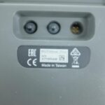
| Country/Region of Manufacture | Taiwan |
| Sensors | GPS |
| Sport/Activity | Fishing |
| Power Source | Electric Corded |
| Type | Head Unit Only |
| Features | Back Light, Chart Plotting, Color Display, Depth Alarm, Depth Indicator, Distance, Distance Indicator |
| Display Size | 7 in |
| MPN | 010-01489-00 |
| Indoor/Outdoor | Indoor/Outdoor |
| Brand | Garmin |
| Manufacturer Warranty | 3 Months |
| Condition | Used |
Related products
-
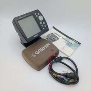
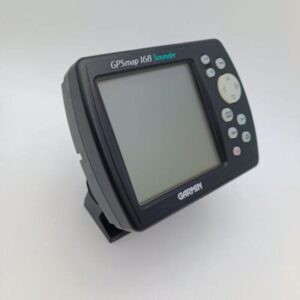
Garmin GPSMAP 168 Sounder Chartplotter w/Manual Pwr Cable Mounting Bracket
USD299.00Out of stock. Join the waitlist to be notified when this product becomes available.