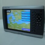

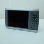
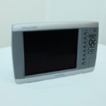
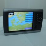
GARMIN GPSMAP 4008 Chartplotter MFD Garmin Network – PERFECT! GUARANTEE!
USD799.00
Out of stock
Want to be notified when this product is back in stock?
Description
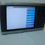
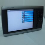
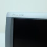
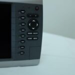
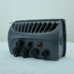
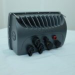
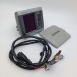
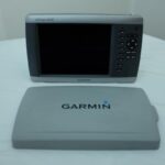
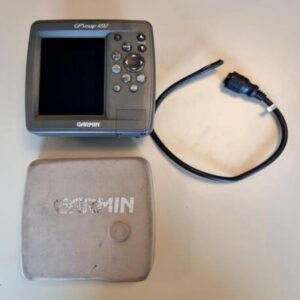
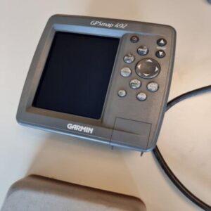
GARMIN GPSMAP 4008 Chartplotter MFD Garmin Network – PERFECT! GUARANTEE!
Works perfectly, fully tested with guarantee.
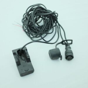
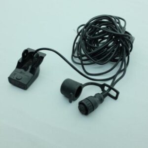
Main unit with sun cover only, no power cable.
********
The power of networking meets the brilliance of great design in this chartplotter, which serves as your all-in-one “nerve centre” for the Garmin Marine Network. The GPSMAP 4008 has video-quality resolution on a 21 cm (8 in). VGA display as well as a worldwide, satellite-enhanced basemap. By connecting to the Garmin Marine Network, you can add sonar and radar. For even more enhanced features, you can add the optional BlueChart® g2 Vision® card.
View High-res Video and Graphics
The 4008 features a worldwide basemap with high-quality satellite images in place of more traditional maps. For more detail, you can add maps easily with the SD™ card slot without having to connect to a computer. The 4008’s high-speed processor draws maps quickly, and its simple intuitive interface makes navigating easy. To keep tabs on your engine room or other area of your boat, you also can connect a live video feed with the 4008’s video input/output options.
Add Extras with BlueChart g2 Vision
With the optional BlueChart g2 Vision SD card, you can add a whole new dimension of exceptional features to your chartplotter.
3D MarinerEye view or FishEye view provides you with a 3-D perspective of chart information, both above and below the waterline.
High-resolution satellite images and aerial photographs help you orient yourself in unfamiliar areas.
Auto Guidance technology searches through all relevant charts to create a route you can actually follow — one that avoids obstacles, shallow water, buoys and other obstructions.
Connect to the Garmin Marine Network
The 4008 connects easily to the high-speed Garmin Marine Network, so you can interface with additional MFDs and add remote sensors. Once connected, you can share information between the 4008 and other chartplotters on your boat. You can also add high-powered radar and sonar to your system.
General
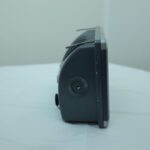
DIMENSION11.2″ x 7.0″ x 4.6″ (28.5 x 17.8 x 11.7 cm)
DISPLAY SIZE
6.9″ x 5.2″; 8.4″ diagonal
(17.5 x 13.2 cm; 21.3 cm diagonal)
DISPLAY RESOLUTION640 x 480 pixels
DISPLAY TYPEVGA display
WEIGHT5.0 lbs (2.27 kg)
WATER RATINGIPX7
MOUNTING OPTIONSBail or Flush
Maps & memory
ACCEPTS DATA CARDS1 SD™ card
WAYPOINTS1,500
NAVIGATION ROUTES20
Sensors
NMEA 2000® COMPATIBLE
NMEA 0183 COMPATIBLE
Chartplotter features
AIS
DSC
GSD BLACK BOX SONAR SUPPORT
ACTIVECAPTAIN MOBILE PLANNING COMPATIBLEYes (Wi-Fi Adapter Kit required, sold separately)
WIRELESS REMOTE COMPATIBLE
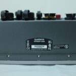
Connections
CONNECTIONS NMEA0183 INPUT PORTS4
VIDEO INPUT PORTS2 – RCA composite
VIDEO OUTPUT PORTS1 – VGA
CONNECTIONS GARMIN MARINE NETWORK PORTS3
Additional
ADDITIONAL
Wifi can only be used with the below compatible Garmin apps.
Garmin BlueChart mobile
Additional information
| Weight | 0.0 g |
|---|---|
| Brand | Garmin |
| Warranty | 1 Year |
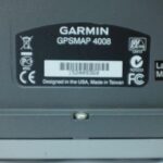
| Manufacturer Part Number | 010-00591-00 |
| Country/Region of Manufacture | Taiwan |
| Condition | Used |
Related products
-

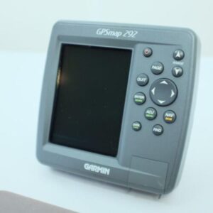
GARMIN GPSMAP 292 Color Chartplotter w/Sun cover, cable -NMEA PERFECT! GUARANTEE
USD399.00Out of stock. Join the waitlist to be notified when this product becomes available. -
GARMIN GPSMAP 492 Color Chartplotter w/Sun cover, cable -NMEA PERFECT! GUARANTEE
USD399.00Out of stock. Join the waitlist to be notified when this product becomes available.