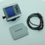
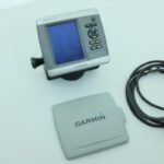
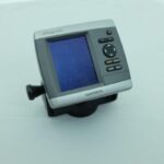
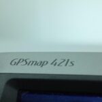


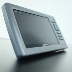
GARMIN GPSMAP 421s SONAR FISHFINDER CHARTPLOTTER GPS NAVIGATION w/COVER WARRANTY
USD474.05
- Condition: Used
- Shipping Info: Fast worldwide shipping
- Return Info: 30-day return policy
- Warranty Info: 90-Day
![]()
1 in stock
Description
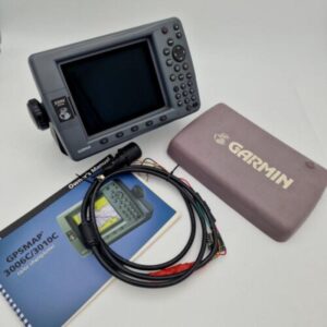
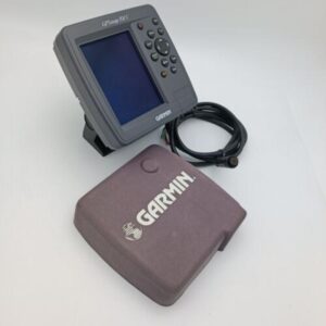
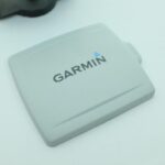
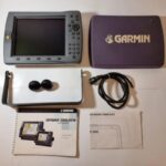
GARMIN GPSMAP 421s CHARTPLOTTER GPS NAVIGATION w/PWR COVER – WARRANTY
Works perfectly, fully tested with guarantee.
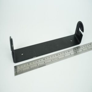
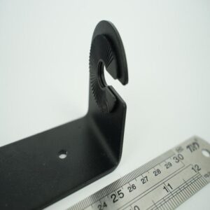
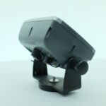
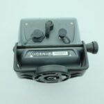
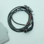
Including the sun cover, mount, power and data cable.
******
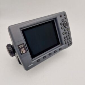
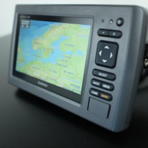
The GPSMAP 421s is a sleek, space-saving chartplotter that features an ultra-bright 4” QVGA display; built-in, satellite-enhanced worldwide basemap and simplified user operation. The 421s also has an SD™ card slot so you can add additional features with the optional BlueChart® g2 Vision card.
View Satellite-enhanced Maps
The 421s basemap contains worldwide satellite images in place of more traditional maps, and its SD card slot makes it easy to add additional maps without connecting to a computer. With fewer keys and a simple, intuitive interface, the 421s makes navigating your way through the water easy.
Add Sonar
Where applicable, the sounder version, GPSMAP 421s, comes with a powerful dual frequency transducer that clearly paints depth contours, fish targets and structure whether you’re fishing in freshwater or off the coast. The 420s is also CANet™ compatible, so you can share sounder data with another chartplotter on your boat.
Add Extras with BlueChart g2 Vision
With the optional BlueChart g2 Vision SD card, you can add a whole new dimension of exceptional features to your chartplotter.
MarinerEye view and FishEye view provide you a 3-dimensional perspective of map information, both above and below the waterline.
High-resolution satellite images and aerial photographs help you orient yourself in unfamiliar areas.
Auto Guidance technology searches through all relevant charts to create a route you can actually follow — one that avoids obstacles, shallow water, buoys and other obstructions.
For a low cost option try BlueChart g2 cards.
General
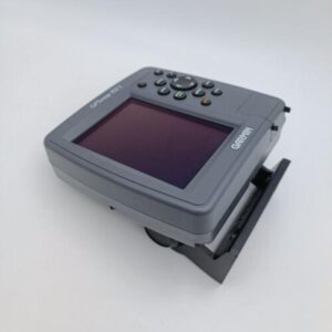
DIMENSION5.7″ x 5.0″ x 2.7″ (14.5 x 12.7 x 6.9 cm)
DISPLAY SIZE2.4″ x 3.2″, 4.0″ diagonal (6.1 x 8.1 cm, 10.2 cm diagonal)
DISPLAY RESOLUTION240 x 320 pixels
DISPLAY TYPEQVGA display
WEIGHT1.3 lb (590 g)
WATERPROOFIPX7
MOUNTING OPTIONSBail with swivel or Flush
Maps & Memory
ACCEPTS DATA CARDS1 SD™ Card
WAYPOINTS1,500
NAVIGATION ROUTES20
Sensors
RECEIVERGPS Receiver
NMEA 0183 COMPATIBLE
Chartplotter Features
AIS
DSC
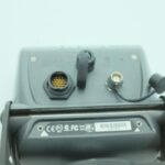
Connections
CONNECTIONS NMEA0183 INPUT PORTS2
Move Marine ApS
Additional information
| Weight | 0.0 g |
|---|---|
| Brand | Garmin |
| Warranty | 90 Day |
| Manufacturer Part Number | GPSMAP 421s |
| Features | Chart Plotting |
| Country/Region of Manufacture | Taiwan |
| Condition | Used |
Related products
-
GARMIN echoMAP 71sv ClearVü Chartplotter Fisfinder Sonar 010-01489-00 – PERFECT!
USD569.00Out of stock. Join the waitlist to be notified when this product becomes available. -


ECHOPILOT SPEED DEPTH Instrument Display ECHO SONAR w/ Transducer Cables
USD199.00Out of stock. Join the waitlist to be notified when this product becomes available.