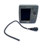
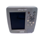
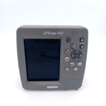
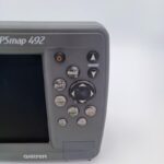
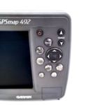
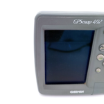
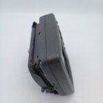
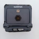
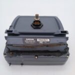
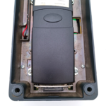
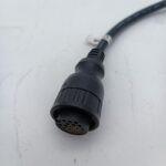
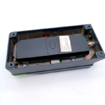
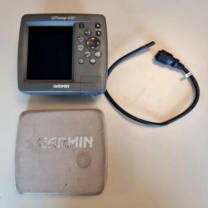
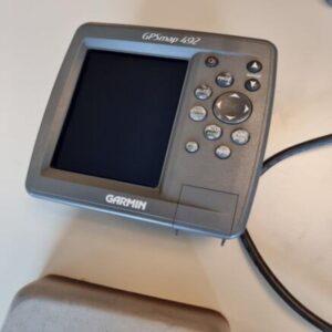
GARMIN GPSMAP 492 Color Chartplotter w/Sun cover cable – NMEA0183 BlueChart
USD379.05
- Condition: Used
- Shipping Info: Fast worldwide shipping
- Return Info: 30-day return policy
- Info Warranty: 90 day
![]()
1 in stock
Description
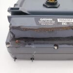
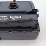
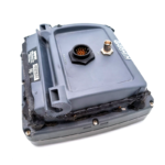
GARMIN GPSMAP 492 Color Chartplotter -NMEA PERFECT! GUARANTEE!
Works perfectly, fully tested with guarantee.
****
Venture offshore with the GPSMAP 492.
Chart Your Course
This rugged, water resistant chartplotter comes preloaded with BlueChart g2 data for the U.S. coast, including Alaska and Hawaii. This detailed map data includes 3D maps, tide and current data, improved IALA symbols, navaids, marinas, boat ramps and coastal roads. There’s even a database of aerial photos, detailed roads and points of interest that you can reference for “real picture” views of harbors and marinas. The 492 can also accept preloaded data cards for additional map coverage.
Connect to Another Plotter
The 492 displays real-time tide and current information, so you can stay aware of changing conditions on the water. It also has Garmin’s proprietary CANet® bus, so you can connect to another chartplotter or sounder on your boat to share information.
GPSMAP 492: Out of the box, onto the boat, off to adventure
General
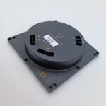
DIMENSION 6.3″ x 6.2″ x 3.1″ (16.0 x 15.7 x 7.8 cm)
DISPLAY SIZE 3.0″ x 4.0″, 5.0″ diagonal (7.6 x 10.2 cm, 12.7 cm diagonal)
DISPLAY RESOLUTION 234 x 320 pixels
DISPLAY TYPE 256-color TFT
WEIGHT 2.0 lb (908 g)
WATERPROOF IPX7
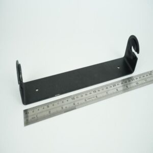
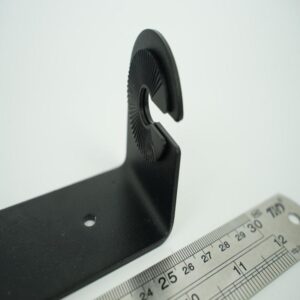
MOUNTING OPTIONS Bail with Swivel or Flush
Maps & Memory
ACCEPTS DATA CARDS 1 Garmin Data Card
WAYPOINTS 3,000
NAVIGATION ROUTES 50
Sensors
RECEIVER GPS Receiver
NMEA 0183 COMPATIBLE
Chartplotter Features
AIS
DSC
GSD BLACK BOX SONAR SUPPORT
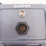
Connections
CONNECTIONS NMEA0183 INPUT PORTS 1
VIDEO INPUT PORTS None
VIDEO OUTPUT PORTS None
GARMIN MARINE NETWORK PORTS None
Move Marine ApS
Additional information
| Weight | 0.0 g |
|---|---|
| Brand | Garmin |
| Warranty | 90 Day |
| Manufacturer Part Number | GPSMAP 492 |
| Country/Region of Manufacture | Taiwan |
| Condition | Used |
Related products
-
GARMIN GPSMAP 492 Color Chartplotter w/Sun cover, cable -NMEA PERFECT! GUARANTEE
USD399.00Out of stock. Join the waitlist to be notified when this product becomes available. -
GARMIN GPS 128 12 Channel Marine Navigator FLUSH NMEA0183 GPS128
USD379.00Out of stock. Join the waitlist to be notified when this product becomes available. -
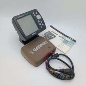
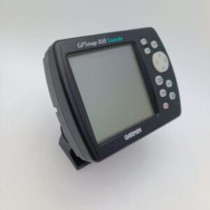
Garmin GPSMAP 168 Sounder Chartplotter w/Manual Pwr Cable Mounting Bracket
USD299.00Out of stock. Join the waitlist to be notified when this product becomes available.