C-MAP MAX EN-M019 Jeppesen – North and Baltic Seas C-CARD Marine Digital Charts
USD265.05
- Condition: Used
- Shipping Info: Fast worldwide shipping
- Return Info: 30-day return policy
- Warranty Info: 90-Day
![]()
1 in stock
Description
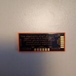
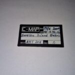
C-MAP MAX MegaWide EN-M019 North & Baltic Seas
Coverage:
The C-MAP chart EN-M019 covers the areas of the entire Baltic Sea and North Sea incl. the northern east coast of England.
The C-MAP chart EN-M019 covers the areas of the entire Baltic Sea and North Sea including the northern east coast of England.
Manufacturer: C-MAP
Format: MAX WIDE
Code: M-EN-M019
Card Type: C Card
Area: NOTH SEA and BALTIC SEA
Max Charts benifit from the following features:
Dynamic NavAids, Dynamic Tides, Gardian Alarm, Route Check, Perspective View, Marina database, points of interest, and Detailed Marina Port Plans including Photos
Works with different chartplotters Barracuda, Furuno, Simrad, Raymarine, Raytheon, NAVMAN etc
Move Marine ApS
Additional information
| Weight | 0.0 g |
|---|---|
| Brand | C-MAP |
| Warranty | 90 Day |
| Manufacturer Part Number | EN-M019 |
| Country/Region of Manufacture | Denmark |
| Condition | Used |