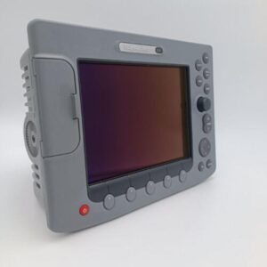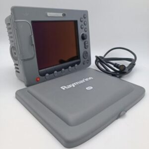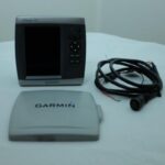
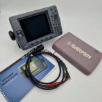

Garmin GPSMAP 555 Marine GPS Chartplotter w/Sun cover + cable – PERFECT! WARRANT
USD499.00
Out of stock
Want to be notified when this product is back in stock?
Description
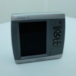
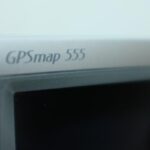
Garmin GPSMAP 555 Marine GPS Chartplotter w/Sun cover + cable – PERFECT! WARRANT
Works perfectly, fully tested with guarantee.
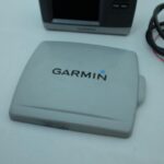
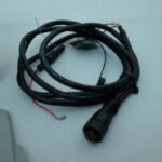
Including the sun cover and power cable.
*****
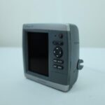
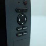
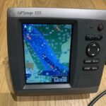
The GPSMAP 555 boasts the brightest, sharpest, most colorful graphics you’ve ever seen on a 5-inch screen. It boasts a 5” VGA display; preloaded detailed maps for the U.K. or Australia; and simple, straightforward buttons and menus. You can add the optional BlueChart® g2 Vision SD™ card for even more enhanced features. For a low cost option try BlueChart g2 cards
Navigate with Ease
The 555 includes detailed coastal maps for the U.K. or Australia as well as a worldwide basemap of satellite images for other areas. The SD card slot makes it easy to add additional maps without connecting to a computer. And with a simple, intuitive interface and high-speed processor, the 555 makes navigating easy.
Add Extras with BlueChart g2 Vision
With the optional BlueChart g2 Vision SD card, you can add a whole new dimension of exceptional features to your chartplotter.
MarinerEye view and FishEye view provide you a 3-dimensional perspective of map information, both above and below the waterline.
High-resolution satellite images and aerial photographs help you orient yourself in unfamiliar areas.
Auto Guidance technology searches through all relevant charts to create a route you can actually follow — one that avoids obstacles, shallow water, buoys and other obstructions.
General
DIMENSION 5.9″ x 6.4″ x 2.9″ (15.0 x 16.3 x 7.4 cm)
DISPLAY SIZE 3.0″ x 4.0″, 5.0″ diagonal (7.6 x 10.2 cm, 12.7 cm diagonal)
DISPLAY RESOLUTION 480 x 640 pixels
DISPLAY TYPE VGA display
WEIGHT 1.75 lb (0.8 kg)
WATER RATING IPX7
MOUNTING OPTIONS Bail with swivel or Flush
Maps & memory
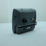
ACCEPTS DATA CARDS 1 SD™ Card
WAYPOINTS 1,500
NAVIGATION ROUTES 20
Sensors
RECEIVER GPS Receiver
NMEA 0183 COMPATIBLE
Chartplotter features
AIS
DSC
Connections
CONNECTIONS NMEA0183 INPUT PORTS 2
Additional information
| Weight | 0.0 g |
|---|---|
| Brand | Garmin |
| Warranty | 90 Day |
| Manufacturer Part Number | 010-00603-00 |
| Country/Region of Manufacture | Taiwan |
| Condition | Used |