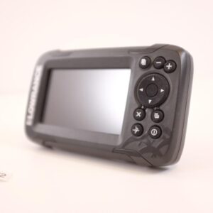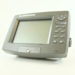
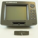
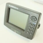
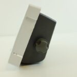
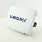
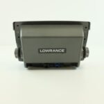
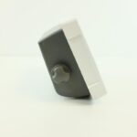
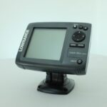
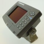
Lowrance GlobalMap 4900m Marine GPS Chartplotter Navigation w/Suncover – PERFECT
USD350.55
- Condition: Used
- Shipping Info: Fast worldwide shipping
- Return Info: 30-day return policy
- Warranty Info: 90-Day
![]()
1 in stock
Description
Lowrance GlobalMap 4900 Marine GPS Chartplotter Navigation w/Suncover
Capabilities
and Specifications:
Display:……………………….
6″ (15.2 cm) diagonal 256-color, 1/4 VGA liquid crystal
TFT display Programmable color pal-
ette (5500C); 7.0″ (17.8 cm) diagonal high-brightness
LCD; programmable to viewing preference (4900M).
Resolution:………………….
240V x 320H resolution; 76,800 total pixels (5500C); 640 pixel x 480 pixel resolution
307,200 total pixels; 10-level gray scale (4900M).
Backlighting:……………….
Advanced cold cathode screen backlit screen with multiple lighting levels;
keypad (5500C); Fluorescent cold cathode backlit screen with multiple lighting
levels; backlit keypad (4900M).
Input power:……………….
10 to 15 volts DC.
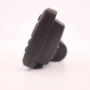
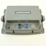
Case size:…………………….
7.3″ H x 9.6″ W x 3.7″ D (18.5 x 24.4 x 9.4 cm); sealed and
waterproof; suitable for saltwater use.
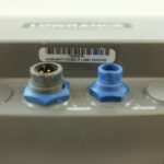
MMC slots: ………………….
Two in waterproof compartment (SD card compatible).
Back-up memory: ……….
Built-in memory stores GPS data for decades. User settings are stored when unit
is turned off.
Languages:………………….
10; menu languages selectable by user. GPS Receiver/antenna: ……… External;
LGC-12w 12 parallel channel GPS/WAAS.
Recording:……………………
MMC & SD memory cards for recording GPS trip details and displaying charts
or custom
maps.
Background map:……….
Built-in custom, detailed Lowrance map.
Contains: enhanced detail of continental U.S. and Hawaii.
Includes more than 60,000 nav aids and 10,000 wrecks/obstructions in coastal and
Great Lakes waters. Metro areas, selected major streets/highways and interstate
exit services details included.
Custom mapping: ……….
MapCreate
6 software optional; optional plug and play LEI FreedomMaps
offer the same high-detail without the computer work of MapCreate. Other plug
and play mapping options include IMS Fishing Hot Spots, LEI NauticPaths
charts and Navionics charts.
Mapping memory: ………
Up to 1GB on one MMC (or SD) card.
Position updates:
………. Every second.
Position points: ………….
1,000 waypoints; 1,000 event marker icons.
Move Marine ApS
Additional information
| Weight | 0.0 g |
|---|---|
| Brand | Lowrance |
| Warranty | 90 Day |
| Manufacturer Part Number | 4900m |
| Condition | Used |
Related products
-
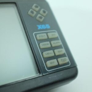
Lowrance X65 Depth Finder Head Unit Sonar Fishfinder EAGLE Boat Marine Sounder
USD79.99Out of stock. Join the waitlist to be notified when this product becomes available.